Pavement Condition Assessment AI
Find potholes, cracks, rutting, and faded markings in vehicle and drone video, and score every road segment without a windshield survey.
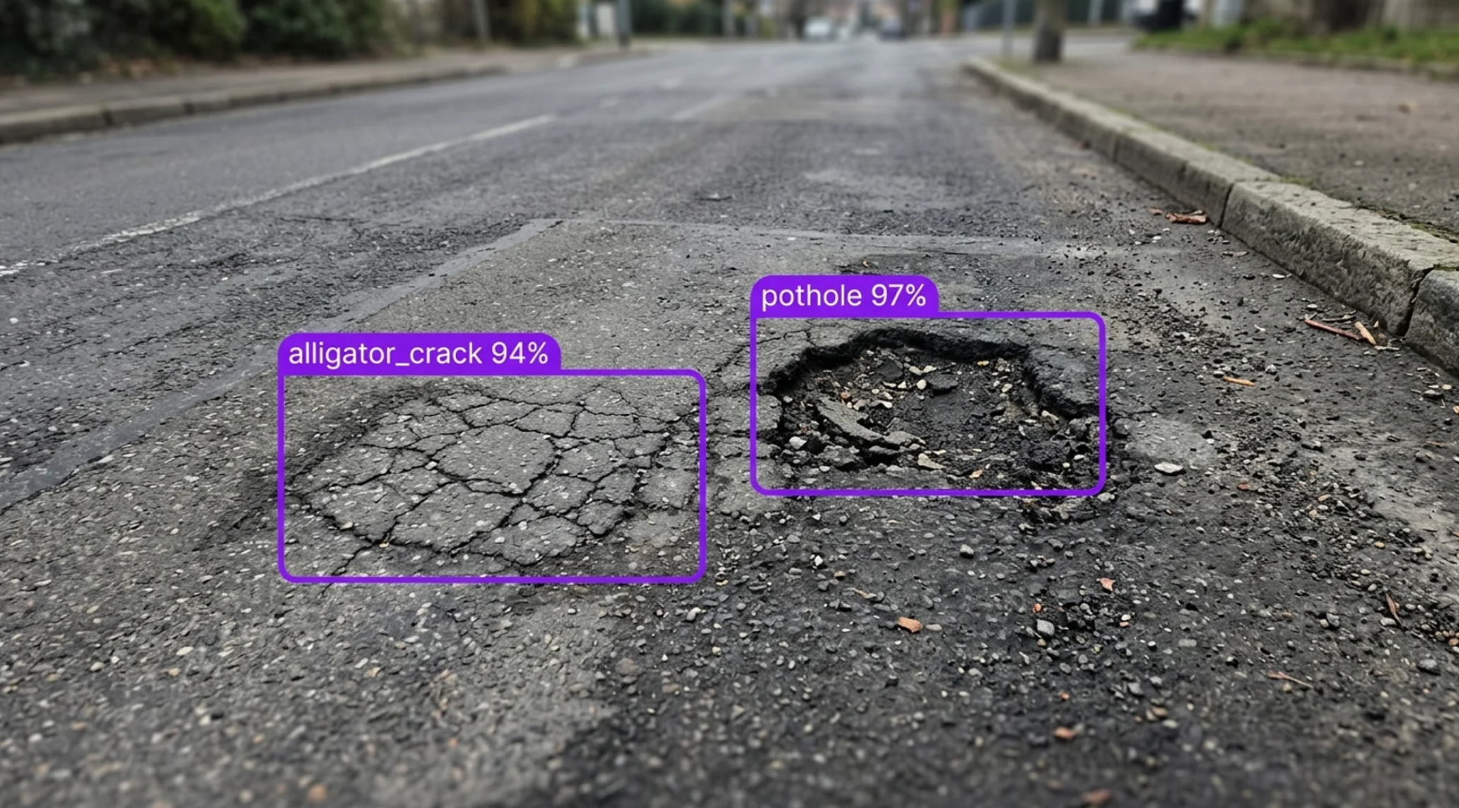
Pavement Condition Assessment AI for the Toughest City Streets, Highways, and Road Networks
Deploy Anywhere, Run Everywhere
Run pavement condition assessment on dashcam, survey vehicle, drone, and street-level imagery, on the edge in the vehicle, in the cloud, in your VPC, or via API.
One Platform, Full Adoption
Tools every road team can adopt, from public works crews and pavement engineers to asset managers and engineering consultants, no separate ML team required.
Secure, Compliant, and Audit-Ready
Data stays safe with SOC 2 Type II compliance, encrypted data, HIPAA compliance, and an uptime SLA, with an annotated, timestamped image behind every defect and segment score.
- Potholes & Patches
- Longitudinal & Transverse Cracks
- Alligator Cracking
- Rutting & Raveling
- Faded Lane Markings
- Road Signs, Poles & Guardrails
“Achieving positive results using AI in a lab environment is easy, but the real challenge comes when scaling the solution across a network like ours without disrupting day-to-day operations. Our partnership with Roboflow is allowing us to do just that.”
Asim Ghanchi
AVP of Technology, BNSF
Talk to a Vision AI engineer who's shipped in roads and transportation infrastructure.
Bring us your toughest pavement condition problem and we'll map a working solution.
Ask us about:
- Solution architecture that fits your vehicles, cameras, rating method, and GIS
- A live demo on your own dashcam, survey vehicle, or drone footage
- Deployment options: cloud, batch, edge, on-prem, or VPC
- ROI modeling against survey costs, inspection hours, damage claims, and repair backlog
Over 16,000 organizations build with Roboflow.
- Rivian
- Pella
- Chobani
- USG Corporation
- BNSF Railway
- American Woodmark
Vision AI is transforming businesses
Customers across the board are solving complex challenges and driving meaningful impact.
- Automotive customer
$10 million
Saved by automatically detecting defects on the production line
- Logistics & freight company
90%
Less time spent manually tracking shipping inventory
- Building materials supplier
60%
Lower customer return rate with improved product quality
Score Every Road, from the First Crack to the Full Network
Add an automated survey layer to every mile of road with Roboflow vision AI for pavement condition assessment. Built for cities, counties, state DOTs, and the engineering firms that serve them, where a windshield survey covers the network once every few years, potholes open up between surveys, and two inspectors can rate the same block differently.
Find the distress:
- Detect potholes, patches, and utility cuts, with a model trained on dashcam and survey vehicle video from your own roads.
- Find longitudinal, transverse, and alligator cracking, plus rutting, raveling, and edge breaks, and segment each distressed area so it can be measured, not just counted.
- Run the same models on drone imagery of road corridors, with tiled inference that catches small cracks from altitude.
Map the right of way:
- Inventory road signs, utility poles, guardrails, and curb ramps, and flag damaged, leaning, or missing assets.
- Check lane markings and crosswalks for fading, and spot litter and debris on the roadway and shoulder.
- Pair every detection with the GPS position and timestamp from your vehicle or drone, so each finding lands on the right segment in your GIS.
Plan the work:
- Count each defect once as the vehicle drives past it, with object tracking across video frames, and roll results into a condition score for every segment.
- Compare runs over time to see which roads are getting worse, and move the worst segments to the top of the repair list.
- Export annotated images and defect logs for work orders, capital plans, and reporting, and extend the same models to haul roads at mines and quarries.
Bring intelligence to every mile today. Get a current, image-backed condition score for your whole network without a windshield survey.
Frequently asked questions
What is pavement condition assessment with Vision AI?
Pavement condition assessment with Vision AI runs a trained computer vision model on road video and images to find potholes, cracks, rutting, and other distress, measure how much of each segment is affected, and tie every finding to its location. Every defect comes back with an annotated image.
What cameras and imagery does it work with?
Dashcams and survey vehicle cameras, 360 and street-level cameras, drone flights, and phone photos from field crews. Models are trained on your own footage, so they learn your pavement types, climate, and markings.
Can it produce a condition score for each road segment?
Yes. Tracking counts each defect once, segmentation measures the distressed area, and a Workflow rolls defect type, extent, and count into a score for each segment, using the rating rules your agency already applies, such as PCI.
Can it integrate with our GIS, asset management, and work order tools?
Yes. Roboflow sends defects, scores, and annotated images over a REST API or webhooks to GIS, pavement management, and work order systems. After a survey run, batch processing can process a whole network's footage at once.