
Waypoint Transit envisions a future where urban planning is accelerated through AI-powered insights and automation. Founded by urbanists and transportation enthusiasts, Waypoint's mission is to streamline planning for city governments, enabling them to execute projects efficiently and cost-effectively.
Urban planning faces considerable challenges, particularly due to the reliance on manual, repetitive, and time-consuming tasks from manipulating GIS (Geographic Information System) data to reviewing plans. One major obstacle is data collection, which often requires planners to perform extensive in-person fieldwork to gather comprehensive and current information about infrastructure, such as sidewalks and curbs. This manual approach not only prolongs project timelines but also significantly increases planning costs, making the overall process less efficient and more resource-intensive.
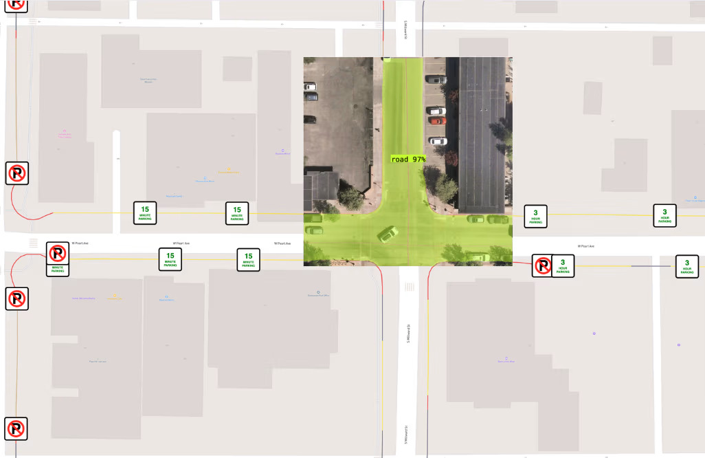
Waypoint addresses these challenges by automating repetitive urban planning tasks using advanced machine learning models, including computer vision. Leveraging AI models developed and deployed with Roboflow, Waypoint can extract critical geospatial features from satellite imagery, such as curbs, roads, or sidewalks, and compile detailed reports for city planners.

One notable project involved "daylighting" intersections to enhance pedestrian safety. By analyzing satellite imagery, Waypoint's vision models identify curbs and classify their usage (e.g., parking zones, red zones, or driveways). Furthermore, Waypoint’s automated platform analyzes these curbs to automatically analyze the costs and benefits of daylighting each intersection, allowing for teams to prioritize the most impactful projects.
Roboflow plays a crucial role in Waypoint's ability to deliver these solutions. They have developed and deployed computer vision for analyzing satellite imagery in Roboflow, training highly accurate models even with datasets as small as 400 images. "Roboflow is incredibly useful for rapid development of vision models,” explained Ryan Johnston, Co-founder and CTO of Waypoint Transit. “When we encounter a city planning challenge, like identifying crosswalks in satellite imagery, we just upload the images to Roboflow, train a model, and then immediately test and deploy in the cloud.”
For image analysis, Waypoint relies on Roboflow's cloud infrastructure for efficient processing. "When running our vision models, we leverage Roboflow's cloud infrastructure for inference,” Johnston explained. “This capability lets us process thousands of satellite images and scale seamlessly based on project demands, eliminating the significant cost and effort of owning and maintaining our own hardware."
Waypoint's daylighting project demonstrates the tangible impact of vision AI in urban planning. By automating repetitive tasks and digitizing critical infrastructure data, Waypoint empowers cities with actionable insights. This not only saves significant time and resources but also enables governments to bridge data gaps, make smarter, faster, and more data-driven decisions, ultimately contributing to safer and more efficient urban environments.
Waypoint Transit envisions a future where urban planning is accelerated through AI-powered insights and automation. Founded by urbanists and transportation enthusiasts, Waypoint's mission is to streamline planning for city governments, enabling them to execute projects efficiently and cost-effectively.


