Wildfire Smoke Detection AI
Catch the plume in the first minutes, across every camera in the territory, without burying the desk in fog alarms.
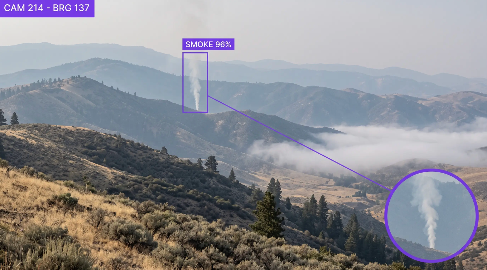
Wildfire Smoke Detection AI Across Camera Networks, Right-of-Way, and High Fire-Threat Districts
Deploy Anywhere, Run Everywhere
Run wildfire smoke detection on your existing PTZ and fixed camera network, partner and ALERTWildfire feeds, the edge at remote sites, on-prem, in your VPC, or via API, wherever your service territory and high fire-threat districts need it.
One Platform, Full Adoption
Tools every utility organization can adopt, from wildfire mitigation and vegetation leads to grid operations, meteorology, and the situational awareness desk, no separate ML team required to ship and own detection models.
Secure, Compliant, and Audit-Ready
Data stays safe with SOC 2 Type II compliance, encrypted data, and an uptime SLA, with detection and response records that support CPUC wildfire mitigation plans, AB 1054 safety certification, and state WMP reporting.
- Early Smoke Plume Detection
- Long-Range PTZ Camera Coverage
- Night Glow & Thermal Signatures
- Fog, Dust & Cloud False-Positive Filtering
- Ignition Correlation with Fault Events
- Detection-to-Dispatch Time Records
Talk to a vision AI engineer who's shipped smoke detection on live camera networks.
A plume that goes unnoticed for twenty minutes on a red flag afternoon, a fog bank that trips the desk so often operators stop trusting the alarm, or an ignition after a fault that nobody correlates until the morning briefing can mean a fire that outruns initial attack, a shutoff called wider than the day required, or a liability case built out of your own response timeline. Bring us your toughest wildfire smoke detection problem and we'll map a working solution.
Ask us about:
- Solution architecture for CPUC wildfire mitigation plans, AB 1054 safety certification, and state WMP reporting across California, Oregon, Colorado, and the Southwest
- Live demo on your own camera network imagery, across your terrain, your seasons, and your known false-positive sources
- Deployment options: existing PTZ and fixed cameras, partner and ALERTWildfire feeds, edge at remote sites, on-prem, air-gapped, or VPC, with integration into your situational awareness platform and dispatch
- ROI modeling against detection-to-dispatch time, false alarm volume, shutoff scope decisions, and wildfire fund exposure
Over 16,000 organizations build with Roboflow.
- Rivian
- Pella
- Chobani
- USG Corporation
- BNSF Railway
- American Woodmark
Vision AI is transforming businesses
Customers across the board are solving complex challenges and driving meaningful impact.
- Automotive customer
$10 million
Saved by automatically detecting defects on the production line
- Logistics & freight company
90%
Less time spent manually tracking shipping inventory
- Building materials supplier
60%
Lower customer return rate with improved product quality