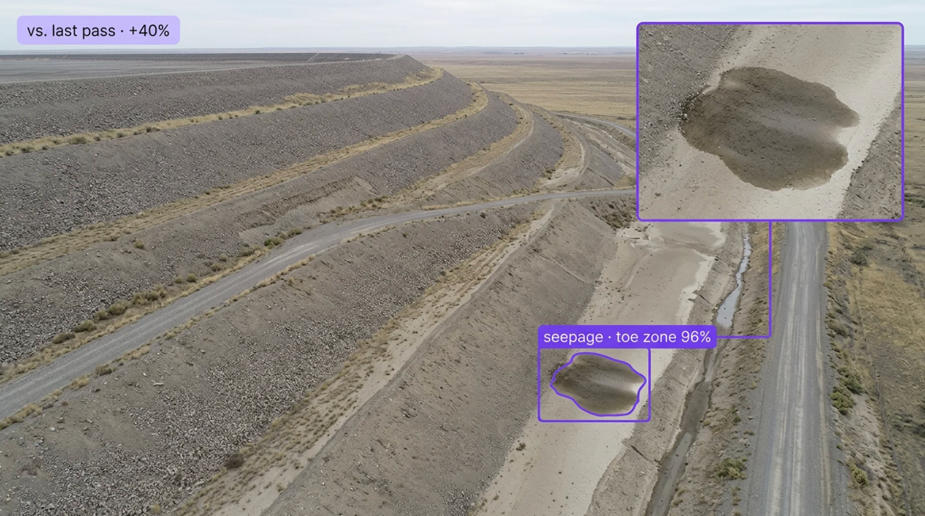
Add a detection layer to every face with vision AI for tailings dam and slope monitoring. Built for the operations where a facility is inspected weekly on foot and monthly by drone, the radar and the piezometers see displacement and pore pressure but not the wet spot or the crack, the surface sign that precedes the instrument reading is visible for days before anyone is standing in front of it, and the record of what the face looked like on a given day is a photo in someone's phone. Roboflow watches the surface from fixed cameras, drone passes, and satellite scenes, flags what changed, and hands the geotechnical team a georeferenced frame with the date on it.
Cracks, Movement, and Erosion:
- Detect tension cracks, scarps, bulging, and slumping on crests, downstream faces, and pit benches, and track their length and position across passes, so the crack that grew is escalated and the one that did not is a record
- Detect erosion gullies, rilling, and surface raveling on embankment faces and dump slopes, so surface degradation is a work order before it becomes a stability question
- Detect rockfall and raveling on pit walls and highwalls, so the bench below is cleared and the wall zone is flagged
Water, Seepage, and Freeboard:
- Detect seepage, wet spots, boils, and vegetation change on downstream faces, toes, and abutments, so the seepage that would have been found on the next walk is found on the day it started
- Measure freeboard, beach length, and pond position against the design criteria from crest cameras and drone imagery, so the pond that moved toward the embankment triggers before the TARP threshold is crossed
- Detect spillway, decant, and drain blockage, debris, and pooling, so the water that should be leaving is confirmed leaving
Inspection, Governance, and Systems Integration:
- Run detection on every scheduled and unscheduled pass, and on continuous fixed-camera feeds between them, so the inspection interval is the camera's, not the calendar's
- Build a dated, georeferenced imagery record of every face, so the Engineer of Record and the review board see what the facility looked like and how it changed
- Push detections into geotechnical monitoring platforms and TARP workflows alongside radar, InSAR, and piezometer data, with per-inspection records behind every observation
Bring intelligence to every face today. Stop tension cracks, seepage, and beach loss from becoming the trigger found late, the decision made on old photos, or the failure mode the board was trying to rule out.
More About Tailings Dam and Slope Monitoring
What is tailings dam and slope monitoring with Vision AI?
Tailings dam and slope monitoring with vision AI uses computer vision models to watch the surface of tailings storage facilities, pit walls, waste dumps, and heap leach pads from fixed cameras, drone imagery, and satellite scenes: tension cracks, scarps, and slumping, seepage, wet spots, and boils, erosion gullies and raveling, freeboard, beach length, and pond position, spillway and decant blockage, and rockfall, and to track what changed between passes. Detections come back georeferenced with the frame and the date, and land in geotechnical monitoring platforms and TARP workflows with per-inspection records that support GISTM and ICMM governance, MSHA 30 CFR 77.216 impoundment inspections, and CDA and ANCOLD dam safety practice.
Can Vision AI find a new tension crack or wet spot on an embankment face?
Deep-learning models trained on your actual facility, materials, and lighting learn what a tension crack, a scarp, a seep, a boil, and a gully look like on your embankment, and comparison against previous passes turns a single frame into change detection, so a crack that lengthened or a wet patch that spread is escalated and a stable feature is a record. Thermal imaging where you have it separates the seep from the shadow, and every detection comes back with the location, the frame, and the date, so the geotechnical engineer is looking at the spot on the face and the day it appeared.
Does this replace our slope stability radar, InSAR, and piezometers?
No. Slope stability radar and InSAR keep their role measuring displacement, piezometers keep their role measuring pore pressure, prisms and LiDAR keep their surveys, and the TARP thresholds, the Engineer of Record, and the GISTM governance stay as they are. Vision AI adds what the instruments do not see: the surface signs, cracks, seepage, erosion, freeboard, beach, pond, and blockage, coverage between walks and flights from fixed cameras, change detection between passes, and a dated imagery record of every face. Instrument readings and vision detections land in the same monitoring record and the same TARP, and the wet spot that would have been noted on next week's walk is in front of the engineer today.
Can it integrate with our geotechnical monitoring platforms and TARP workflows?
Yes. Roboflow Inference exposes a standard API and supports common industrial protocols, so detections flow into your existing systems: geotechnical data management and monitoring platforms, dam safety and TARP workflows, GIS such as Esri ArcGIS, and site SCADA and alarm systems, through REST, MQTT, and direct database writes. Each detection carries the class, confidence, coordinates, face or zone, frame, source, and date, so an observation can be logged, compared to the previous pass, escalated against a TARP level, and reviewed by the Engineer of Record with the imagery attached, with a full record behind every inspection for governance and audit.